Somerset
Urbex Map Tonedale Mills, Tonedale
SomersetEnglandUnited Kingdom
Regular lifetime updates
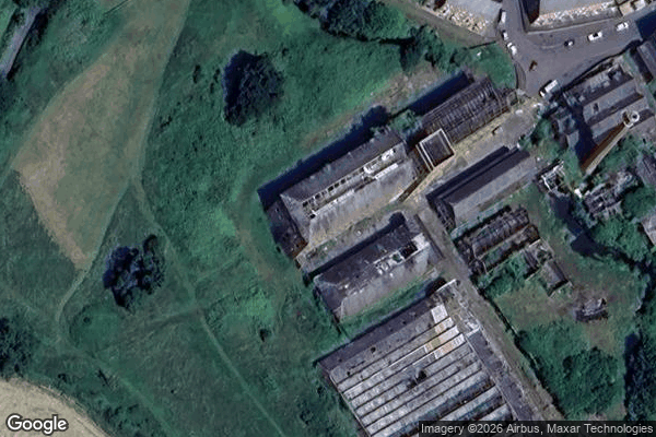
Tonedale Mills, Tonedale - Coordonnées GPS Urbex
Obtenez la coordonnée GPS exacte de ce lieu abandonné situé dans le département Somerset (England, United Kingdom). Spot urbex vérifié et géolocalisé.
Tone Dale House (or Tonedale House) is a Grade II listed country house built in 1801 or 1807 by Thomas Fox in Wellington, Somerset, England. Wellington lies 7 miles (11 km) west of Taunton in the vale of Taunton Deane, 1 mile (1.6 km) from the Devon border. Tone Dale House, also known as House of Fox, offers views of Somerset which include the Quantock hills to the north and the Blackdown Hills to the south.
0,90EUR
Paiement unique - accès à vie
100% Secure Checkout
AMEX
Google Pay
stripe
SSL encrypted · No banking data stored
Ce qui est inclus
- Coordonnée GPS exacte
- Photo satellite du spot
- Accès immédiat après achat