St Helens
Lost Places Karte Parkside Colliery
St HelensEnglandVereinigtes Königreich
Lebenslange Updates
Parkside Colliery - Coordonnées GPS Urbex
Obtenez la coordonnée GPS exacte de ce lieu abandonné situé dans le département St Helens (England, Vereinigtes Königreich). Spot urbex vérifié et géolocalisé.
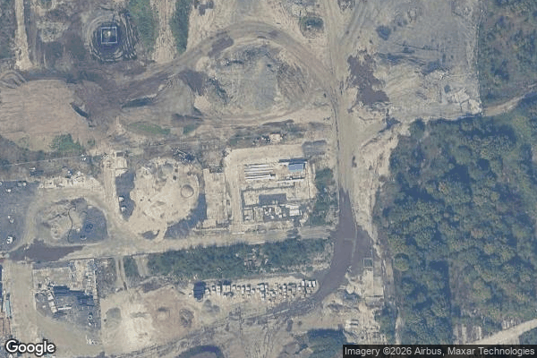
Parkside Colliery was a coal mine in Newton-le-Willows, in the historic county of Lancashire, but from 1974, until its closure in 1993, it was in Metropolitan Borough of St Helens, in the metropolitan county of Merseyside. It was always described as being in Lancashire, and was the last deep coal mine operating in the Lancashire Coalfield upon closure.
0,90EUR
Paiement unique - accès à vie
100% sichere Zahlung
AMEX
Google Pay
stripe
SSL-verschlüsselte Verbindung · Keine Bankdaten gespeichert
Ce qui est inclus
- Coordonnée GPS exacte
- Photo satellite du spot
- Accès immédiat après achat