Urbex Map Stockport
13 abandoned places in Stockport

13
spots
One-time payment - lifetime access
100% Secure Checkout
SSL encrypted · No banking data stored
Regular lifetime updates
Themes included in this pack
- Churches
- Abandoned houses
All abandoned places in Stockport
13 verified GPS coordinates in the department of Stockport, England, United Kingdom.
Looking for abandoned places in Stockport, England, United Kingdom? Urbex Maps offers 13 verified GPS coordinates of abandoned buildings in this area, including Churches, Abandoned houses.
13
verified spots
GPS
Google Maps, Waze
July 2026
last update
Where to find abandoned places in Stockport?
The best way to find abandoned places in Stockport is through the interactive urbex map on Urbex Maps with 13 verified GPS coordinates. Top categories are Churches, Abandoned houses.
Types of abandoned places in Stockport
- Churches
- Abandoned houses
Spots in Stockport

Bramhall Moor Lane, Bramhall
Cheadle Hulme
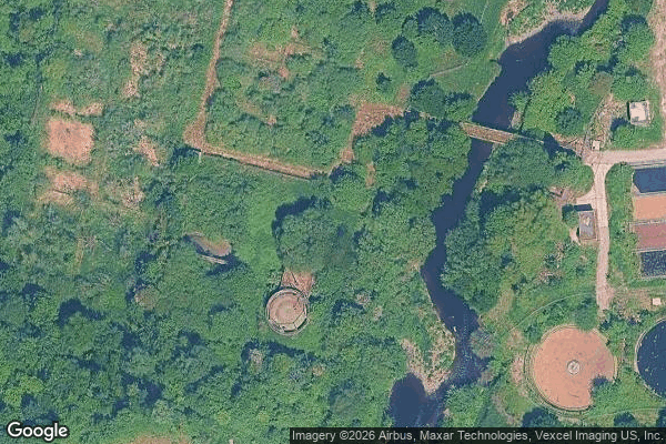
Compstall Mills, Stockport

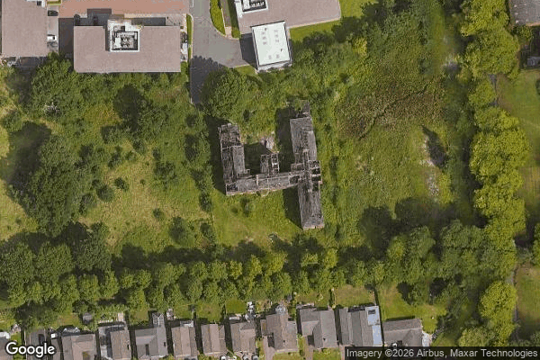
Congregational church

Gordon House

King Street West, Stockport
Little Moor, Stockport

Mauldeth Road, Cheadle

Mulberry Mount Street, Stockport
The Imported Spatial Void

Traces of the Vector
Vertices of the Void
Wellington Street, Stockport
Urbex FAQ for Stockport, United Kingdom
Is urban exploration legal in Stockport, United Kingdom?+
What types of abandoned places can I find in Stockport, United Kingdom?+
How do I use the GPS coordinates I've purchased?+
How many abandoned places are listed in Stockport, United Kingdom?+
What's the best season for exploring in Stockport, United Kingdom?+
What our articles say about these places
The site is derelict but watched, and slated for redevelopment : a company named Compstall Mill 2025 Ltd bought the four-acre estate at auction and is drawing up plans for up to 135 homes, so this window is closing too. As of 2026 the historic buildings are still standing . This is private land within a conservation…Read the article : Abandoned Places in Manchester: 5 Derelict Sites →
