Wiltshire
Urbex Map Imber
WiltshireEnglandUnited Kingdom
Regular lifetime updates
Imber - Coordonnées GPS Urbex
Obtenez la coordonnée GPS exacte de ce lieu abandonné situé dans le département Wiltshire (England, United Kingdom). Spot urbex vérifié et géolocalisé.
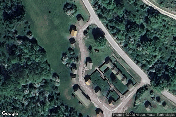
St Giles' Church is in the deserted village of Imber, Wiltshire, England, which since 1943 has been within the British Army's training area on Salisbury Plain. The church was built in the late 13th or early 14th century. It is recorded in the National Heritage List for England as a Grade I listed building, and is now a redundant church in the care of the Churches Conservation Trust.
0,90EUR
Paiement unique - accès à vie
100% Secure Checkout
AMEX
Google Pay
stripe
SSL encrypted · No banking data stored
Ce qui est inclus
- Coordonnée GPS exacte
- Photo satellite du spot
- Accès immédiat après achat
This place appears in these articles

What our articles say about this place
The Ministry of Defence has held Imber ever since and uses it as an urban-warfare training ground, with mock buildings standing among the genuine ruins. The medieval church of St Giles, Grade I listed, is preserved by the Churches Conservation Trust, while the cottages and Imber Court are empty shells. The village o…Read the article : Abandoned Places in the UK: Top 10 Urbex →